
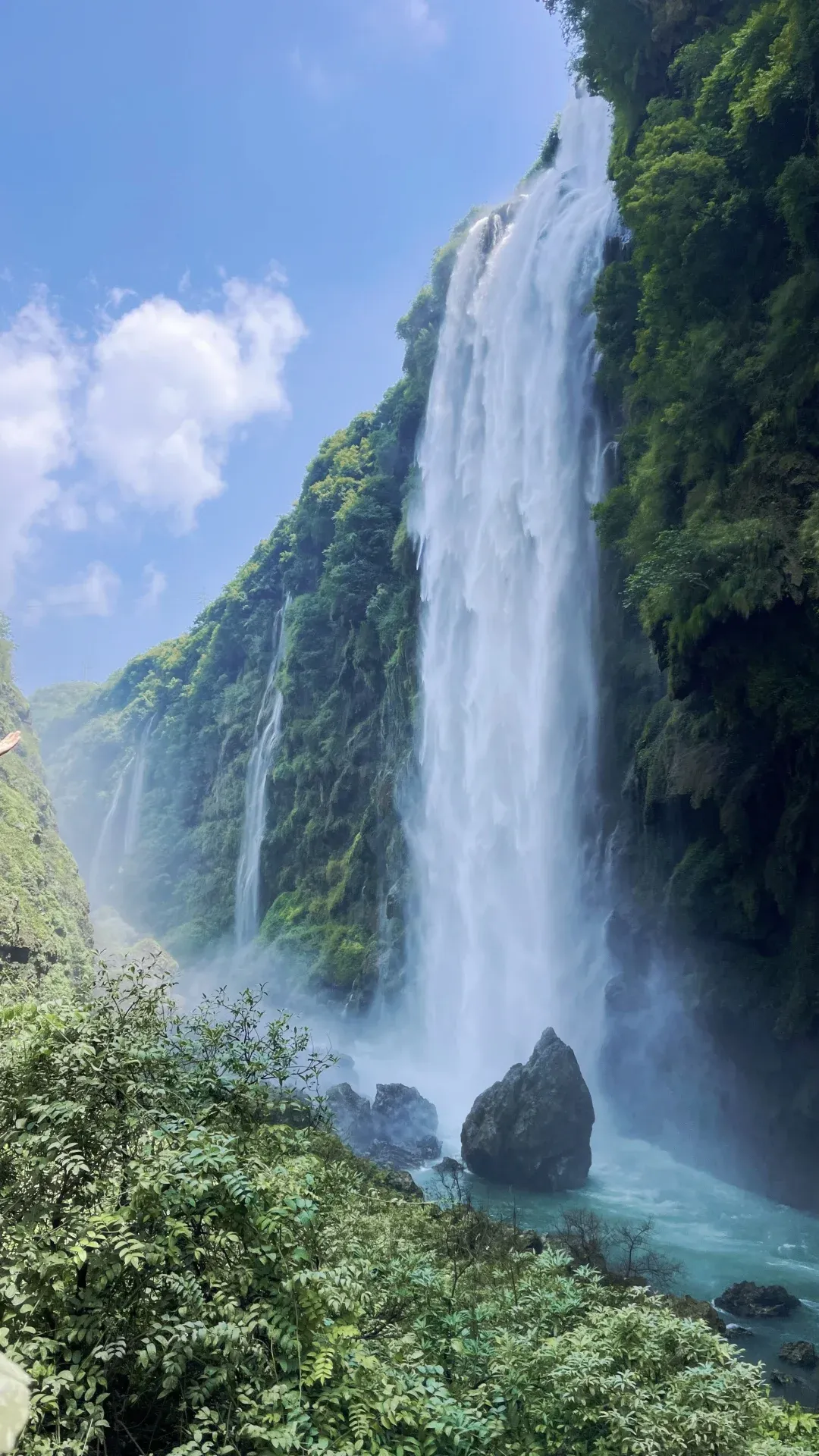
Maling River Canyon
A 74.8 km karst earth-fissure canyon near Xingyi with 70+ waterfalls and 200,000 sq m of travertine cliffs.
 Written and signed by Alex Chu
What it actually is
Maling River Canyon is a 74.8 km karst (limestone landscape eroded by water) earth-fissure canyon 5 km east of Xingyi, with 120-280 m cliff walls, 70+ waterfalls, and travertine (calcium-carbonate) cliffs. Designated a national scenic area and Xingyi Geopark member, it offers a family-friendly trail and a 16 km whitewater section that hosted China's first international kayaking event in 1998.
Editor's take
Worth it if you catch it in flood season or just after rain and you're up for a stair-heavy hike — go for the Dachaiwo overlook and the full waterfall. I'd skip it in winter when the falls are dry, and if your knees are shot, take the elevator or just shoot the free road overlooks instead of committing to the loop.
Essentials
Good to know
Trending now
Hundred-Horse Waterfall (Wan Ma Ben Teng Pu Bu)
Over 70 waterfalls pour simultaneously down a 200 m travertine (calcium-carbonate) wall, with spray so heavy that you need a rain cover for your camera; the viewpoint queue stretches up to 40 minutes on summer weekends but the wide-angle shot with the spray curtain as foreground is the canyon's defining image.
Shuanghong Bridge (Twin-Rainbow Bridge)
The twin-arch bridge spanning the Maling River is the trail's main photo stop; stand at the canyon end with a wide-angle lens and you frame both arches plus the layered rock walls in a single shot, with the rushing river as the foreground anchor.
Dachaiwo bridge overlook (God's-eye view)
Before buying the ticket, walk up to the highway bridge next to the parking lot for a free top-down panorama of the entire 4-5 km fissure, both Shuanghong arches, and the ribbon waterfalls all in one frame; this angle is the most-replicated on Xiaohongshu (a popular Chinese social media app) and is the only place where the full canyon is visible without a drone.
Travertine corridor (Monkey King Palace to Lion Bridge)
A 1 km narrow boardwalk cuts between overhanging calcium-carbonate formations; the ground is wet, the lighting is dim, and the close-up rock textures with stalactite curtains are the subject; the stairway down to the Lion Bridge is the best place to photograph the Wan Ma Ben Teng (Hundred-Horse) waterfall from the side.
Maling River whitewater rafting (China's first international venue)
The 16 km downstream section from the Huanglong Falls boat dock to the Wan Ma He dam hosted China's first international kayaking event in 1998 and has been the national whitewater training base since 2005; boats run at three difficulty grades (ecological sightseeing, leisure, and adrenaline) and depart hourly from the dock in summer.
Tianxing Gallery travertine cliff band
A 2 km stretch of the canyon where travertine (calcium-carbonate) deposits cover more than 300,000 sq m of cliff face in continuous white-to-amber curtains; the calcium-carbonate precipitation has been ongoing for hundreds of thousands of years and the band reads as the canyon's most distinctive geological layer.
Family-friendly descent (no uphill return)
The Dachaiwo entrance is all downhill on a paved boardwalk, so the round-trip is essentially 4-5 km down plus a 30 CNY panoramic elevator back up; this route avoids the toughest climb and is the version xhs (Xiaohongshu) family-travel writers recommend for grandparents and kids above age six.
Xingyi Wanfeng Lin combo (one-day two-park loop)
Wanfeng Lin (Ten Thousand Peaks Forest) is the other member of the Xingyi UNESCO Global Geopark, 30 km east of the city; pairing it with the canyon makes a natural full-day loop (canyon morning, Wanfeng Lin afternoon) because both parks share the geopark bus network and the same ticket office.